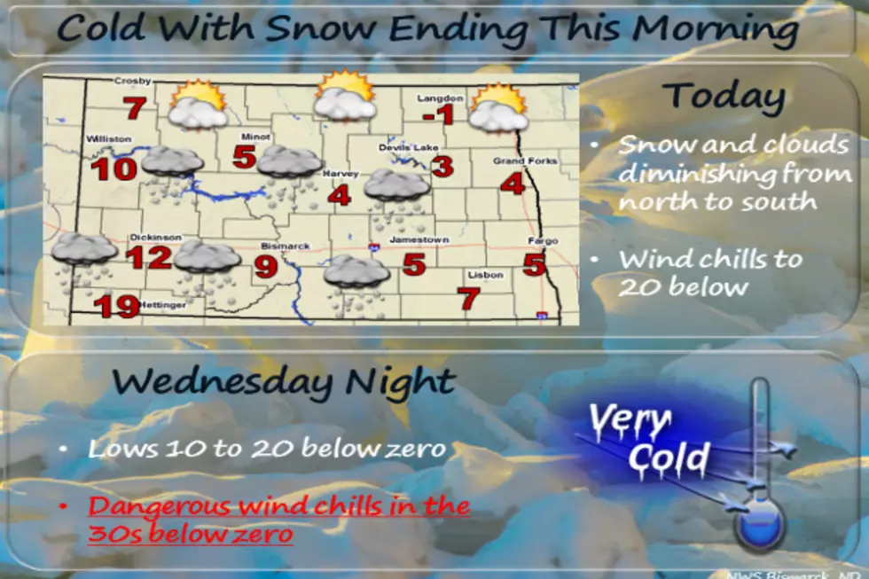
Wind Chill Advisory in Effect for Western and Central ND
A Wind Chill Advisory has been issued by the National Weather Service and will remain in effect until noon CST on Thursday (February 7th).
High temperatures for this entire week have been and are expected to remain below zero and what's worse is that wind chills are forecasted between -40 and -50 for several portions of North Dakota.
Snow is also expected to continue to fall this evening into tomorrow. Blowing snow may also be a hazardous issue on the roads as well.
Temperatures in the immediate Bismarck-Mandan region are expected to be around -11 tonight with snow likely. Thursday's forecasted high temperature is -7 and snow is expected before about 10 a.m. Tomorrow night's temperatures are expected to dip to around -26.
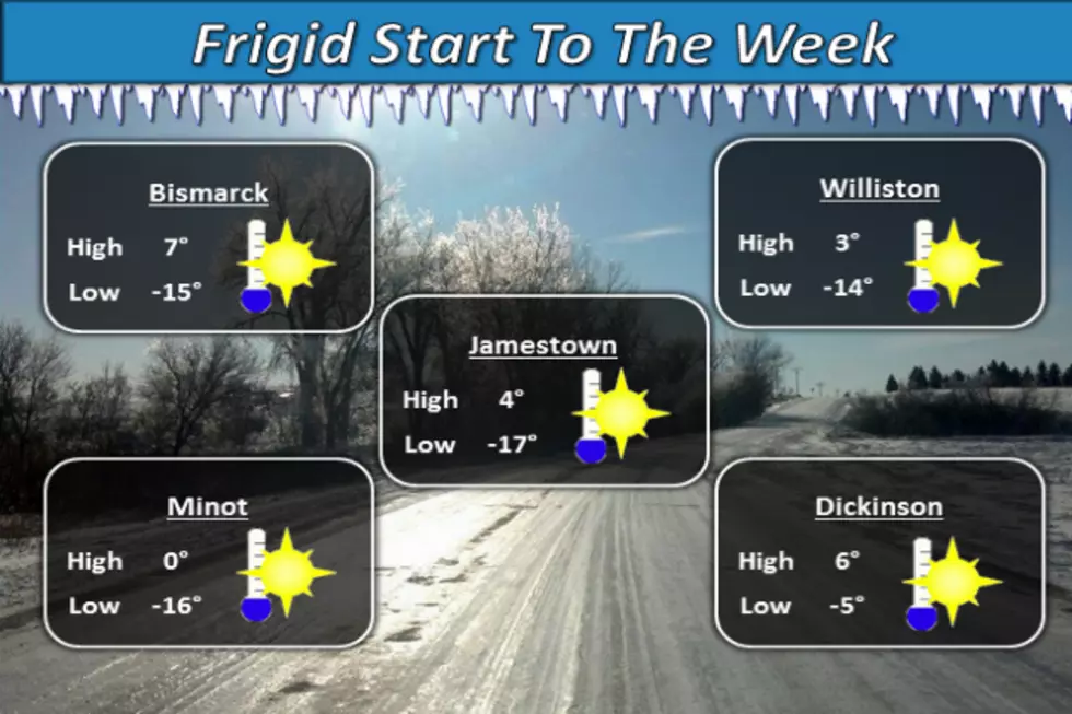
High temperatures in the extended forecast aren't expected to climb above zero when we hit Monday of next week.
During the Wind Chill Advisory, the National Weather Service suggests taking the necessary precautions to wear a hat and gloves to lessen the chance of frostbite to exposed skin as it can occur as little as 10 minutes. Please be safe and stay warm!
More From US 103-3