NWS Predicting Snow for the First Weekend of 2015
Don't let the above normal temperatures fool you as the National Weather Service in Bismarck is predicting snow for the first weekend of the New Year, accompanied with another blast of Arctic air.
The high temperature today (1/1/15) was above freezing in many areas of the state. Expect the same on Friday as we start the weekend.
The change will be felt tomorrow as the area can expect a chance of flurries Friday afternoon through the over night hours. The Bismarck-Mandan area will have a chance of flurry activity through the weekend as another Arctic blast will drop temperatures Saturday through Sunday night and into the first week of 2015. The high will be near zero Sunday with an over night low near 15 below.
Travel could be impacted as the winds will gust up to 25 MPH Friday night that could cause drifting and blowing snow. If you have travel plans, you're encouraged to stay informed and on top of this changing forecast.
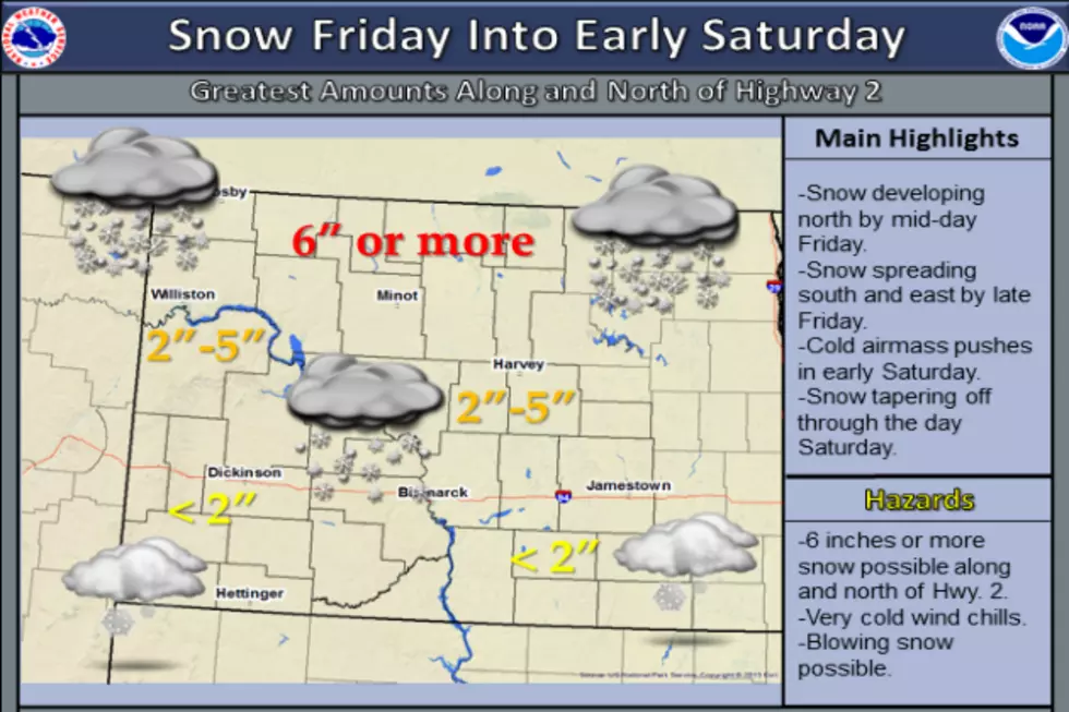
The Northern region of the state including Minot to the boarder, is anticipating more snow than our area and the region South of I 94.
Some areas could receive 6 inches or more. Locally, Bismarck can expect 2-4 inches late Friday into Saturday.
More From US 103-3